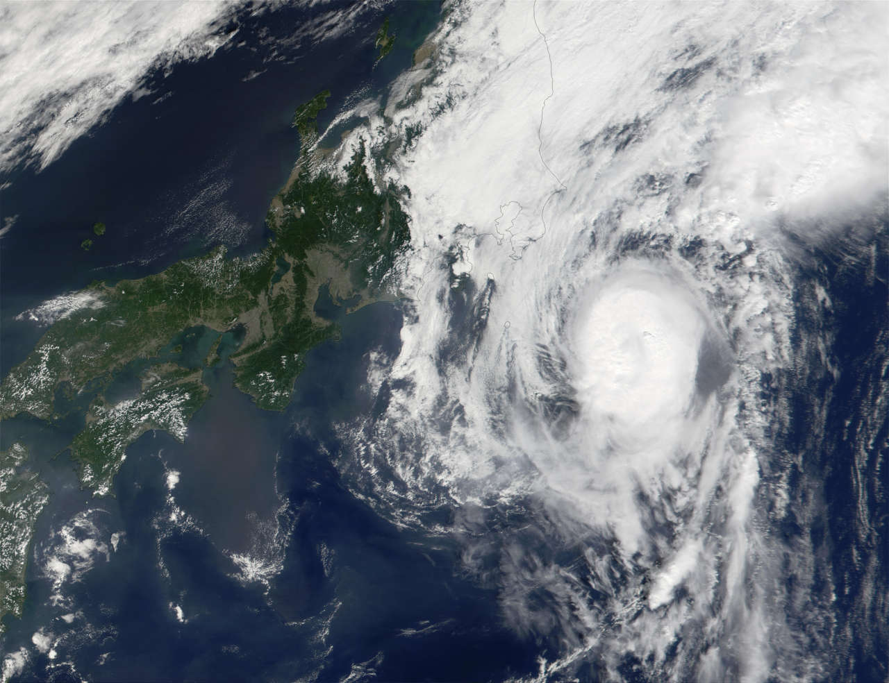


Typhoon Phanfone is lashing Japan's small southern islands with strong winds, high waves and torrential rain as millions on the Japanese mainland brace for what looks to be a direct impact, The Weather Channel reported.
Phanfone is now moving north and will eventually continue its right turn to move toward the north-northeast.
At one point on Saturday, the U.S. military's Joint Typhoon Warning Center analyzed 150 mph winds within Phanfone, designating it super typhoon. The JTWC has since reduced its estimate of those winds slightly.
The Japan Meteorological Agency, the official regional center for tropical cyclone forecasts in the western North Pacific, indicated 10-minute sustained winds as high as 110 mph within Phanfone Saturday, but has lowered its estimates slightly as well. JMA's 10-minute wind speeds are usually lower than the 1-minute wind standard used by the U.S.
As of Sunday morning local time, the strongest winds are being felt on the small Amami Islands, which are a part of Kagoshima Prefecture and lie north of Okinawa. The island of Kikaijima reported a peak gust of 42.2 meters per second (94.4 mph) at 5:45 a.m. Japanese time Sunday. (Japanese Standard Time, or JST, is 13 hours ahead of Eastern Daylight Time in the U.S.)
On Saturday, high winds were felt in the Daito Islands, which are part of Okinawa Prefecture. A wind gust of 101 mph was reported on Kitadaito (North Daito Island) before the wind observations were knocked offline. The other two observation sites on the islands, Minamidaito and Kyuto, gusted over 90 mph. Sustained winds maxed out at 57 to 64 mph at all three locations, safely below typhoon force, but the center of Phanfone was 120 kilometers (75 miles) away at its closest approach according to JMA bulletins.
Although Phanfone is moving into an area of increasing vertical wind shear (changes in wind speed and direction with height) as well as cooler ocean waters, the storm will be slow to weaken and will still be a very intense system as it approaches the larger islands of Japan.